A Hockett Trail Guide: 9. Golden Trout Creek

From here we head up the second native golden trout stream along the Hockett Trail, Golden Trout Creek.

California Golden Trout

The original Hockett Trail was without bridges. Its strategy for crossing the Kern River—the river that drowned John Jordan in 1862—was to follow the river upstream to a broad ford above two major tributaries: Coyote Creek, and what was once known as Volcano Creek and Whitney Creek. The trail then crossed at the ford and ascended eastward through a saddle behind a large knob known locally as Chief Joseph. It then crossed Golden Trout Creek (the stream’s third official name) and climbed up to the the vicinity of Natural Bridge, where the Golden Trout Trail passes today.

The aforementioned fording strategy led to the placement of Lewis Camp, a popular old hang out for Hockett Trail travelers, just north of where the ranger station is today. Even if you’re not about to ford the Kern—and you’re surely wise to avoid it—make sure to take time to wander up the canyon with your rod anyway, and see if you can spot any ruins along the way.

The present-day Golden Trout Trail features a steel-girder bridge, and it crosses the river downstream at a better bridging point, just below Golden Trout Creek. It then climbs out of the canyon along a somewhat more difficult route, just south of Golden Trout Creek.

Along the way, the walker sees numerous signs of geologically recent volcanism, such as columnar basalt, the basalt flows of Malpais (literally “bad country” in Spanish; akin to “badlands”), Natural Bridge, and beyond the flows the cinder cones themselves, active as recently as five thousand years ago.

The basalt fields dominate the floodplain to Groundhog Meadow and the accompanying cinder cone. Beyond this point the basalt persists in a more scattered pattern, and the Golden Trout Trail soon encounters several glacial moraines before ending at Tunnel junction.

See Exploring the Southern Sierra: East Side by Jenkins & Jenkins: Horseshoe Meadow to Kern River Backpack (T114). Also see Hiking California’s Golden Trout Wilderness by Suzanne Swedo: Cottonwood Pass to the Kern River (31).

A Hockett Trail Guide: 8. Kern Canyon Fault

Trout Meadows: the old crossroads of the southern Sierra. Here’s where three trans-Sierra trails crossed: the Dennison, the Jordan, and our Hockett Trail. This is also where the eastern leg of the Hockett Trail begins, and the western leg ends. This is no arbitrary division: the Hockett Trail can very easily be seen as two trails that meet at Trout Meadows.

“The evidence indicates that main-traveled trails from Kaweah and Tule villages led to a common meeting ground near the junction of the Kern and Little Kern Rivers (Round Meadow – Trout Meadows area). If you wished to travel eastward you would travel one of several trails that converged on this meeting place from several Owens Valley points.” — Floyd L. Otter, Men of the Mammoth Forest, pgs. 27-28

As early as 1923, plans were published that would have had the entire eastern half of the Hockett Trail widened and graded for automobile traffic.

The new road, which is to run from Lone Pine in the Owens Valley, up into the high Sierras through Carroll Creek and over Mulky Pass, going westward to the heart of the Kern River country. — Los Angeles Times, November 7, 1926

This was all very exciting, but getting a road built even as far as Horseshoe Meadows proved to be quite a challenge. In 1929, Los Angeles road crews, ever in search of more water resources to exploit, were turned back by the cliffs below Wonoga Peak. Imagine that! The thirsty City of Los Angeles defeated by an engineering challenge!

The road that LA started didn’t get to Horseshoe Meadows until 1967. It may have never made it that far if developers had waited any longer, that being a bygone era. The Hockett route was challenging enough for pack trains; it proved quite prohibitive for auto traffic.

The Big Plan

The ambitious plan included a branch over Coyote Pass as well. It appears that this branch would have continued along Windy Ridge and Dennison Ridge to Milo (what was known ca. 1900 as the Dennison Trail).

Part of the old Jordan Trail would also likely have been part of that grand trans-Sierra project. That would be the segment of the Jordan Trail that backpackers, packers, and equestrians take from Lewis Camp Trailhead to Trout Meadows (33E01). This is another convenient river access point along the Hockett Trail, particularly via the Willow Meadows Trail (trail 33E14).

Dan on the Jordan Trail

From Trout Meadows, the trail heads directly north along the Kern Canyon Fault toward Kern Canyon, where it drops to canyon bottom.

While descending into the canyon, the trail meets a trail (33E05) that drops into the “Hole in the Ground”, certainly a worthwhile side trip for anglers.

Continuing along the Kern Canyon Fault, the trail occasionally striding over distinctive saddles called “kerncols” that keep the trail from the more rugged canyon bottom. The canyon offers a number of good campsites, the most exquisite being those adjacent to Little Kern Lake.

Dan above Little Kern Lake

Just before entering Sequoia National Park, the present-day trail veers away from the old trail by staying close to the river, whereas the old trail rose over yet another saddle. The present-day route is more scenic, but perhaps not quite as practical.

See Exploring the Southern Sierra: West Side by Jenkins & Jenkins: Coyote Lakes Backpack (T58) and Two Rivers Backpack (T59). Also see Hiking California’s Golden Trout Wilderness by Suzanne Swedo: Trout and Willow Meadows (10) and Little Kern Lake (14).

A Hockett Trail Guide: 7. Little Kern Valley

Here, near the headwaters of the Little Kern, is where the Golden Trout leg of the Hockett Trail begins, and the native country of my favorite variety of golden trout.

The Little Kern Golden Trout

Ladies and gentlemen, present … fly rods!

… or just sit by the stream and enjoy the show.

The Little Kern descends quickly, then levels out as it flows down a v-shaped canyon toward its confluence with Shotgun and Rifle Creeks. Trail 31E12, which once formed a shortcut between Wet Meadows and Coyote Pass, has been unmaintained since 1995 at least, but the recent Cooney and Tamarack fires may have helped to clear away the accumulated overgrowth (undergrowth to the trees; overgrowth to the trail). About halfway down the canyon, the trail enters another zone of meta-sedimentary schist and marble.

The Hockett Trail and the Great Western Divide

Again, a shortcut to the Kern Canyon follows unmaintained trail 31E12 up over Coyote Pass. Though the original Hockett Trail did not cross the Great Western Divide, and all the accounts that I have read indicated travel around the divide, some early travelers probably did cross the divide at Coyote Pass as a late season alternate. That said, I have seen no early maps that indicate that the Hockett Trail itself crossed the divide; in fact, the only Coyote Pass trail I’ve seen indicated by maps before 1958 was not associated with the Hockett Trail, but proceeded from Mineral King. This is the same general trail that crosses the divide at Coyote Pass today. On an 1896 map of Sequoia National Park, it was labeled the “Poison Meadows Trail”, and “Dangerous”.In Chapter Three of The Challenge of the Big Trees, Lary M. Dilsaver and William C. Tweed indicate that the Hockett Trail did indeed cross the Great Western Divide, but the only details they provide on the matter contradict that indication:

“The Hockett Trail began near Tharp’s Ranch on the Kaweah River, ascended the South Fork of the Kaweah to the subalpine plateau now known as Hockett Meadow, then crossed into the Little Kern; it briefly combined with the Jordan Trail only to diverge to the north again and cross the main Kern in the vicinity of Kern Lake.”

The only way the cited passage could be true is if the trail skirted around the Great Western Divide, and met the Jordan (Dennison) Trail at Trout Meadows.

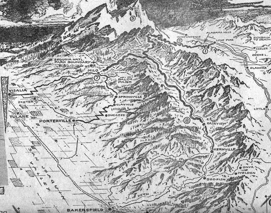
“There are four well beaten trails entering the valley of the little Kern from Tulare Valley and all unite before reaching the Big Kern.” … the roughest, up the South Fork of the Kaweah.” — P. M. Norboe (1903), cited by Floyd L. Otter, Men of the Mammoth Forest, pg 32

W.F. Dean of the Mt. Whitney Club included the following description of the Hockett Trail in an account of a trip that he took in July 1897 from Mineral King to the Chagoopa Plateau:

“We then followed the Hockett trail, via Round Meadow, Lion Meadow, and Burnt Corral Meadow.”

Note that this traveler skirted around the Great Western Divide as late as July, and that he identified the name “Hockett Trail” with that circuitous route.

Still, in spite of so much evidence, local common knowledge has it that the Hockett Trail had a late season branch over the Great Western Divide. Old hearsay dies hard.

From Rifle Creek, unmaintained Forest Service Trail 32E02 follows the river south. The original Hockett Trail ascends southward over a saddle, then descends to join 32E02, and follows that same trail, also unmaintained, to Trout Meadows.

After following the river for about a mile, trail 32E02 veers away from the Little Kern, and does not return to it, but there are places where it is not very far from the river. One such place is where the old Dennison Trail probably merged with the Hockett Trail, at Sagebrush Gulch.

Juan fords the Little Kern

A short hike along the north side of Sagebrush Gulch on unmaintained trail 32E11 takes you down to the Little Kern ford where that mountaineer and man of leisure Dennison may have crossed on his way to the Coso Range. He probably came down off the Western Divide along Mountaineer Creek (wouldn’t that be appropriate?), but we can access this ford more easily via Clicks Creek (also on trail 32E11).

See Exploring the Southern Sierra: West Side by Jenkins & Jenkins: Coyote Lakes Backpack (T58) and Two Rivers Backpack (T59). Also see Hiking California’s Golden Trout Wilderness by Suzanne Swedo: Lion Meadows Loop (11) and Northern Golden Trout Tour (20).

A Hockett Trail Guide: 6. The Western Divide

After crossing Hunter Creek, the incline increases as the Hockett Trail leaves the Hockett Plateau for the Western Divide. After ascending 850 feet, the trail reaches a ridgecrest that might deceive a traveler into thinking he’s reached the top, but he has another 300-foot climb ahead. All-in-all, it’s not a difficult ascent to the divide at Wet Meadows Entrance (9824′).

The original boundary of the park actually extended eastward beyond Wet Meadows to a longitude line. Since 1978, the Wet Meadows Entrance has been an entrance into the Golden Trout Wilderness.

The Western Divide is the divide that lies west of the Kern watershed, from Farewell Gap (above Mineral King) to the Greenhorn Mountains. It may be thought of as a branch of the Great Western Divide. It is not, as a whole, given a name on maps, so I take the name from the Western Divide Highway (California State Route 190). It is the first of two divides crossed by the Hockett Trail (the original trail skirted around the Great Western Divide).

On the eastern side of the divide, the trail (31E11) descends toward the Little Kern. The first signs of Wet Meadows bring the trail to a group of large campsites and the roofless remains of a cabin built by the Pitt brothers. At the downstream end of the meadows, there is a rather well-developed camp worth visiting. Be warned, though, that the trail splits at the meadow, and the branch adjacent to the meadow is not maintained.

Below the meadow, the trail encounters a trail to Quinn Patrol Cabin (31E13) on the right. From this junction, trail 31E11 continues toward Mineral King, and we descend in an east-southeast direction into the canyon of the Little Kern, taking care to stay south of the hump that rises just south of Wet Meadows Creek. The descent becomes increasingly more steep into the canyon. The last 400 feet are the worst. This route, once-upon-a-time trail 31E12, has not been maintained, or even used for many years, due to the facts that (1) trails in and out of Mineral King provide alternatives that did not exist in the 1860s, and (2) the Forest Service has not maintained trails in the Golden Trout Wilderness since 1995. Thankfully, some routes are maintained by packers, volunteers, and cowboys. There is hope, however, for this abandoned classic: the 2003 Cooney Fire may have cleared some of it for us.

This leg of the Hockett Trail ends at the Little Kern River, where we reach the first trout stream in the native range of the California golden trout. 31E12 and the old Hockett Trail crossed the stream here, as the canyon is more navigable on the east side. The river is relatively calm here, and the canyon bottom is relatively broad. The outlet stream of Wet Meadows, the Little Kern’s first tributary, flows into the river just upstream. See if you can spot the benchmark 7923 on the east side of the river.

See Exploring the Southern Sierra: West Side by Jenkins & Jenkins: Hockett Meadows–Little Kern River Backpack (T93).

A Hockett Trail Guide: 5. Hockett Plateau

The Hockett Plateau is a glacier-carved plateau at an elevation of about 8500 feet, from 8200 feet along the South Fork Kaweah River to 9500 feet near Summit Lake.

Dan on the western edge of the Hockett Plateau

This sub-alpine tableland can be covered in snow—not to mention mosquitoes—into summer. It features a wealth of meadows, plus a number of glacial tarns well on their way to becoming meadows. Soon after the snow melts, this maze of meadows blossoms into a paradise that has been protected for nearly 120 years now, and so has fared much better than similar meadowlands along the route.

Upon reaching the plateau, the Hockett Trail forded the South Fork Kaweah River, probably at the same point is crosses the river today. Once it crossed, however, it did not ascend the hill to Hockett Lakes as the present-day trail does, but rather proceeded east along the north side of the stream until reaching the far edge of the plateau. Along the way, the trail passes Sand Meadows and South Fork Meadows.

Soon after South Fork Meadows, one comes to a trail junction. The Hockett Trail is to the left and continues along the north side of Hunter Creek. The trail to Windy Gap proceeds to the right, up the South Fork.

The Hockett Trail and the Little Kern

A alternate to the lower Little Kern is accessible via Windy Gap. It crosses less rugged terrain adjacent to Soda Springs Creek, but crosses the Little Kern where the stream has a greater flow, so crossing is a bit more of a challenge. As many historic sites as are offered by this alternate, I have not seen any map from before 1940 (going back to 1896) that shows a continuous trail from Windy Gap to the Little Kern via Soda Spring. Furthermore, no maps or early accounts that I have seen associate that route with the Hockett Trail. Most access to the historic sites along this route, particularly after 1890, was probably via Balch Park Road.

Not long after the Hockett Trail was blazed to the plateau, ranchers drove livestock to its meadows. Clarence King fictionalized such a group of ranchers in his story The Newtys of Pike (Mountaineering in the Sierra Nevada, Chapter 5), based upon his visit to the Hockett Plateau in July 1864. King claimed to have met a family of hog farmers on the Hockett Plateau during this 1864 trip. A Hog farming family was elsewhere reported to have grazed their hogs on Hockett Plateau in 1864 (see Modern Settlement: The Early Explorers ). King appeared to use some license, as was the norm at that time. He may have had the song “Sweet Betsy from Pike” in mind when he wrote the tale.

King took the Hockett Trail as far as Golden Trout Creek, during his second unsuccessful attempt at climbing Mt. Whitney, and then returned on the same trail. He did not have much to say about the Hockett Trail, though at one point he claimed to have found a very pleasant campsite on the plateau; too pleasant, he claimed, to permit him to divulge its location. What little he did say about the trail must of course be subject to skepticism as he tended to take some liberty with his accounts.

Good camping can be found all along this leg of the trail from the river crossing to the confluence of Hunter Creek and the river. Hunter Creek can be a bit unappetizing as a source of water, but it will certainly do in a pinch.

See Exploring the Southern Sierra: West Side by Jenkins & Jenkins: Hockett Lakes–Summit Lake Backpack (T86) and Hockett Meadows–Little Kern River Backpack (T93).

A Hockett Trail Guide: 4. Ladybug vs. Garfield

Clough Cave is not the only cave in the South Fork area. There are four that I have heard of, one of which was discovered in 2006 and featured in National Geographic. Hundreds of such caves occur in marble outcrops which appear in the Sierra’s eroding meta-sedimentary shell. There are at least a half dozen such outcrops in the South Fork area.

At South Fork Campground we are confronted by a choice between (a) following the river to Ladybug and (b) ascending up the south face of the canyon.

The original Hockett Trail stayed near the river to just beyond Ladybug. This is the most direct route, but it requires two additional river crossings, and adds a very steep ascent after Ladybug.

The Hockett Trail and the South Fork, 1896
The Hockett & Salt Creek Trails (1896)

The difficulty of the second crossing is not trivial. It is in a small gorge, and the river rushes precipitously downhill there. I lost a water bottle several years back attempting to ford the river just upstream. The last bridge that crossed at Ladybug was washed out (as were others) in the winter of 1969. After that, the Hockett Trail was no longer maintained from end to end, unless one considers the Garfield-Hockett Trail a branch of the Hockett Trail, which I do.

Garfield Grove on an October morning

The reasons I have for considering the high route through Garfield Grove to be part of the Hockett Trail are:

  1. it is probably a superior route to the original one that was abandoned in 1969
  2. it serves all the needs of the original trail
  3. it is adjacent to the original trail and rejoins it quickly

The original trail does avoid snow in the early season, but I’ll take snow over snow melt just about every time. Consider Christopher McCandless.

Still, Ladybug is a great spot for trout fishing and, of course, lady bugs.

My friend Juan and I recently attempted to follow the old ascent up the big hill, but found that it was every bit as overgrown as we had been told. We found ourselves crawling through low-lying tunnels under thickets, hoping to come though to an opening, but the tunnels just kept on going.

Nothing that a good fire couldn’t fix.

The alternative is a long, strenuous haul up the north side of Dennison Ridge, but it offers plenty of shade, moderate slopes, frequent water sources, beautiful forests, stately campsites and all without any drowning hazard. Even with ice on the ground, this route is quite safe in most places.

One of the last wild nesting sites of the California condor before its reintroduction was a fire scar in a giant Sequoia tree, just on the other side of Dennison Ridge. Dennison Ridge, Dennison Peak, and Dennison Mountain get their names from a mountaineer who blazed the first trail across the southern Sierra. It is said that he died after stumbling over his own bear snare, just on the other side of this ridge that bears his name. Dennison's Chili

Legal camping on the Garfield route begins at Snowslide Camp, just beyond Snowslide Canyon, source of the infamous 1876 slide, what I like to call the “Centennial Slide” as a mnemonic. Downstream, at canyon bottom where the slide planted a small Sequoia grove, is the first legal campsite along the old route: Ladybug Camp. Above Ladybug, the old trail gets mighty steep and dry, so there isn’t really any other good camping along this leg of the old route.

See Exploring the Southern Sierra: West Side by Jenkins & Jenkins: Hockett Lakes–Summit Lake Backpack (T86) and South Fork Kaweah River Day Hike (T87).

A Hockett Trail Guide: 3. South Fork Drive

This leg starts just above the South Fork bridge where the Old Three Rivers Highway meets Sierra Drive. The original route was probably closer to the path of present-day Cherokee Oaks Drive, but that’s a dead end. What is today called the Old Three Rivers Highway ends at South Fork Drive, which our route follows to its end. South Fork Drive was not completed into Sequoia National Park until well into the 20th Century. The upper portions of the drive were until fairly recently considered the Hockett Trail. Well after the time cars were driving to Giant Forest, and after backpackers were crossing great iron bridges along the High Sierra Trail, there was still no road entering Sequoia National Park along the South Fork. The road ended at Cahoon Ranch, well outside the park. The upper portion of the road that was later cut and blasted out of the mountainside remains quite primitive, and can offer quite a bumpy ride.

The Hockett Trail's entry into Sequoia National Park

The Hockett Trail’s entrance into Sequoia National Park, 1899.

South Fork Drive crosses the river three times, each a potentially critical watering hole. Cinnamon Creek is also a useful water source. Always treat water at these elevations, unless you get it out of someone’s spigot.

My best guess is that the three river crossings represent the 2nd, 3rd, and 4th crossings of the original Hockett Trail over the South Fork. The terrain appears to dictate these crossings. The first crossing was probably well above the present-day Sierra Drive bridge over the South Fork. The old Hockett Trail probably crossed the South Fork at seven places.

This leg probably should not be attempted in August. My brother and I bicycled up from Tulare as teenagers, and suffered. We walked our bikes most of the way up from Three Rivers. It is probably best attempted on bicycle, just use a bike that’s been maintained, and be prepared for a workout: the elevation gain is 2800 feet. On the other hand, it’s a very enjoyable return ride, with reasonable grades and light traffic. One can always drive, of course, but don’t forget to stop and smell the cow pies. There is some very pleasant country along South Fork Drive.

See Exploring the Southern Sierra: West Side by Jenkins & Jenkins: Highway 198 Car Tour (T84).

The Devil’s Tinderbox

From the first crossing of the South Fork Kaweah River above Three Rivers (elev. 962 ft) to tree line on Hockett Hill above Owens Lake (approx. elev 6700 ft), the Hockett Trail is, with few exceptions, a forested trail. Even the Coyote Pass alternate over the Great Western Divide is well-forested. The only places where trees do not accompany the trail are where it crosses the Malpais lava flow and large meadows such as Tunnel, Mulkey, and Burnt Corral Meadows.

There are few places, however, where the woods that accompany the Hockett Trail could be rightly described as rain forest. Perhaps portions of Garfield Grove might be described as such with some imagination, but the original Hockett Trail didn’t even have that (it was routed below the grove on a sunny ridge).

There are streams, but nearly no lakes. Kern and Little Kern Lakes were born of landslides in 1867/8, after the Hockett Trail’s creation. Kern Lake is more of a marsh at present than a lake, and will soon be a meadow. Little Kern Lake might necessarily need to drop the adjective from its name.

The southern Sierra Nevada is drier than the rest of the range, but there’s no lack of growth, and in many places undergrowth. In fact, the southern Sierra has forests and even chaparral at elevations where there would only be tundra in other parts of the range.

I’ve often encountered forest fires on or near the Hockett Trail. That ought to surprise no one, with all the sunshine and firewood at the ready.

I missed the 2002 McNally Fire, which spared the Hockett Trail, but managed to burn nearby Hockett Peak.

Little Kern Lake during the West Kern Fire.

Little Kern Lake during the West Kern Fire.

The year after the McNally Fire, I had planned to backpack up the Little Kern River, but the Cooney Fire got in the way. My friend Juan and I backpacked up Kern Canyon instead, where we witnessed the West Kern Fire. Two years later, the Kern Fire struck the Kern Canyon. The next time I planned a trip up the Little Kern River was in 2006. That year, the Tamarack Fire got in the way. The Kern Canyon was hit again by the Grouse Fire in 2007. Every one of these 1000+ acre fires—except the McNally—were ignited by lightning.

The Golden Trout Trail

The Hockett Trail was first chosen for its efficacy as a trans-Sierra route, and specifically chosen by the Union Army for its usefulness as a trail between forts in Visalia and the Owens Valley. Coincidentally, or perhaps not so coincidentally, the route of that old trail also traces the native range of California’s distinctive sport fish, the California golden trout. In addition, the Hockett route follows streams east and west of that native range. This makes the Hockett route an ideal route for the sport fisherman.

The three watersheds of the golden trout are, from west to east, the Little Kern River, Golden Trout Creek, and the South Fork Kern. The Hockett Trail followed these streams from its crossing of the Little Kern at Wet Meadows Creek, down the Little Kern Valley, up Kern Canyon, Golden Trout Creek, and finally the South Fork Kern.

“Here the trail branches, and there are two routes to Big Cottonwood, two or three miles further on. Both routes are plain. The one following up the east bank of the stream leads over a low divide between Little and Big Cottonwood, and brings one finally to the last-named. Here is an ideal camp; wood, water, grass, and trout are in plenty. The wonderful golden trout of the Sierras are here, in overwhelming abundance. It is no exaggeration to say that the poorest angler can here at almost any time of day catch strings which would drive the frequenter of local streams wild.” — Hubert Dyer, Sierra Club Bulletin, 1893

The attractiveness of the Hockett route isn’t limited to the Kern watershed. On the west side, the Hockett Trail followed the Kaweah River from the Kaweah Delta to the headwaters of the South Fork Kaweah. On the east side, the Hockett Trail followed Cottonwood Creek, stocked with golden trout since 1876, before dropping down “Hockett Hill” into the Owens Valley and turning north toward the Owens River, yet another notable fishing stream of the region.

Today, the Hockett Trail route and the trout streams along it enjoy wilderness protection from South Fork Campground on the west side to the outskirts of Horseshoe Meadows on the east side, largely due to the creation of the Golden Trout Wilderness in 1978. Unfortunately, fishing on the lower Owens River is not what it was before the Los Angeles Aqueduct, though efforts are being made to restore the stream. As for the state of the trail itself, it is not wholly maintained, and segments of the original trail were completely abandoned as far back as 1969 and 1940. Much of the original route is now paved over, and some of it has been under Lake Kaweah since 1962.

The Early Hockett Trail

The trans-Sierra supply route of the Civil War period commonly known as the Hockett Trail was completed in 1862-63 for two functions:

  1. moving miners and supplies to and from mines in the Coso Range east of the Sierra.
  2. moving soldiers and their supplies to and from Fort Independence (AKA Camp Independence). This was primarily to defend and promote the interests of white settlers against local Indians.

The first function, the commercial reason for the trail, is the reason why the trail was named after the Visalia businessman John Hockett. For this same reason, the Hockett Trail may also rightly share the name “Coso Trail” with the Dennison and Jordan Trails.

The second, military function is the reason why it was also called the “Trail to Fort Independence”. Hockett and the Union Army worked together in developing the trail.

The Hockett Trail found other uses before it was even completed. It served as a route for discovering and accessing new Sierra peaks and valleys. Mineral King was discovered by a hunter on the Hockett Trail crew in 1862 (Hale Tharp later claimed to have visited Mineral King earlier, but even if he did his visit had no historical impact). Ranchers appear to have used the trail to move their livestock to the Hockett Plateau during the drought of 1863.

Though the Hockett Trail was the primary trail across the southern Sierra throughout the late 19th Century, it probably did not serve the Cerro Gordo mines, as they were not generally known until after the Hockett Trail lost much of its purpose as a supply route with the completion of the McFarlane toll road over Greenhorn Mountain in 1864, the opening of a stage service on that road in 1865, and the end of the Owens Valley Indian War in 1865.

The city of Los Angeles gained dominated trade with Cerro Gordo by 1868, and her geographic advantage over Visalia became clear. By 1905, as work on the Los Angeles Aqueduct began, Owens Valley was in practical terms within LA’s city limits.

The completion of Mineral King Road in 1879 diverted traffic away from the westernmost segment of the Hockett Trail, but it may have made the rest of the trail even more popular. The original Hockett Trail, often labeled the Trail to Fort Independence, can be seen skirting around the end of the Great Western Divide on area maps throughout Sequoia National Park’s first decade (the 1890s).

“The Hockett trail was made in early days, and to-day it remains a plain, well-blazed track from Lone Pine through to Visalia.” — Hubert Dyer, Sierra Club Bulletin, 1893

Mountaineering, golden trout, and the establishment of Sequoia National Park kept the trail popular into the 20th Century. The first people to climb Mount Whitney, America’s highest peak until 1959, were fisherman who used the Hockett Trail to get to the Kern River, and the Hockett route continues to give sport fisherman access to some of the most striking freshwater fish in the world.