Vulture, by Robinson Jeffers

In Igneous Range, the vulture is the firebird, a symbol of ancient Iran, and a symbol of transcendence.

To be eaten by that beak and become part of him, to share those wings and those eyes …

Published posthumously in 1963.
Jeffers Literary Properties
Stanford University Press
Reading © 2017 Kaweah

For more discussion on this and other Jeffers poems, see Robinson Jeffers: Fire from Stone.

©2017 Kaweah (Dan Jensen)

The Summit Redwood, by Robinson Jeffers

There is an outlaw thread in Igneous Range, so one of the Robinson Jeffers poems that it reminds me of is the Summit Redwood:

First published in 1928
Reading by Kaweah

A companion lyric to Cawdor and a splendid fire-poem in its own right, The Summit Redwood has never been selected for any anthology, possibly because it appears to put “people of color” in a bad light, or perhaps because its style appears to be inconsistent. I happen to see it as a marvelous portrait of kindred defiants: a red tree and a red man.
Redwoods don’t often grow on summits, particularly on the coast, but often enough for the purposes of this poem. They are shaken by lightning commonly enough. Continue reading

To the Story-Tellers, by Robinson Jeffers

I wrote most of Igneous Range before I had any idea I was writing a Jeffers novel, thematically anyway: violence, vultures, redwoods, defiance, and above all fire. A repeating theme is the dominance of the subconscious, and there is also a sense of insanity.

Oh, and there’s genocide as well.

Toward the end of the story, Armen encounters a crazy old man in a cave who preaches the insanity of man. He does not mean that man is evil; only that man is not rational:

There are lots of intelligent animals, but there is only one mad animal.

Bonefield

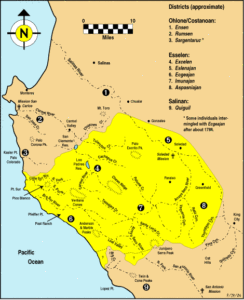
Land of the Esselen

Take the bodies of the land and the sea.
Grind them together for thirty million
summers
and something’s bound to chip off.

Look. Not even the heart is left
unscathed;
hunks of Sierran granite spilled
up and down the coast;
the continent’s bones scattered
across the exposed sea floor
from Bodega Head and Point Reyes in
the north,
past the Farallons, Pinos and Lobos
down to that plutonic shard the Spanish
named
“the South,” where you may have heard
an older people, beyond the cliff,
up the canyon, under the shadows
of the white peak, the red giants; who
spoke in ways foreign to their neighbors.

In that country, all was life,
everything thinking;
rock was memory, and nothing
was too inhuman
to have a name.

© 2014–15 Kaweah

Sierra del Fuego

He knew her best,
I have no doubt of it.
And didn’t he name her better
Than did the Spaniards? Hah!
What did they know?
They never even approached her.

Today I received another incident report
From the Range. She has
taken to burning again.

It’s inevitable.

If you’ve ever walked her wooded elevations
on a day like this, under the faithful
California sun,
you might reckon the thickets and the woods to be
on the threshold of ignition.

What isn’t burning is baking.
You can smell it.

The cold fire of alpenglow on the high peaks,
That is a reminder.

I remember, John, how you waited out a mountain
fire in the charred heart of a Sequoia,
that Giant among giants who needs
a little fire now and then.

I would have liked to have been on Paradise Ridge,
there with you, that night.

I would have been waiting, a little nervously,
for the right time to say,

Now tell me
you never considered

Range of Fire.

© 2013 Kaweah


California v. II

… continued

Metamorphosis

About thirty million years ago, the trailing edge of the Farallon Plate began to disappear under North America in the shape of an inverted 90° wedge, beginning at the location of present-day Los Angeles, and proceeding northeast under the continent, leaving nothing but hot mantle where before was the cold, subducting oceanic plate.

Burial of the Farallon Plate

Burial of the Farallon Plate

Over the past twenty million years, that trailing edge has been crossing the Sierra Nevada region, and it’s traveled nearly as far north as Mount Lassen thus far, creating a great triangle between the trailing wings of the subducted Farallon Plate and the Pacific Plate.

With no more subduction to trigger the kind of volcanic activity characteristic of Mount Lassen and the Cascade Range to the north, the Sierra Nevada has transitioned into a new phase of plutonic activity. The hot, underlying mantle has pressed up through the great triangle, causing uplift and, as the uplifted dome has increased the surface area above, spreading. The spreading, in turn, has created grabens such as Owens Valley.

Though the stone that makes the Sierra Nevada was formed long before this uplift and spreading, it was this event, beginning about thirty million years ago, that actually gave rise to the Sierra Nevada that we know today. Still, there have been much more recent events that have contributed greatly to the general, large-scale structure of the range.

A New Age of Volcanism

This new incarnation of California lacks the Cascadian volcanism of its past, yet the existence of the eruption of the Long Valley supervolcano 760,000 years ago attests to the volatility of the present-day Sierra Nevada. It was an eruption 500 times the size of the 1980 Mt. St. Helens eruption and 30 times the size of the 1883 Krakatoa eruption, surpassed by only four eruptions over the last million years:

  1. Lake Toba, Sumatra, Indonesia
  2. Whakamaru, North Island, New Zealand
  3. Lake Taupo, North Island, New Zealand
  4. Yellowstone Caldera, Wyoming, USA

There are no stratovolcanoes along the spine of the Sierra Nevada, but there is evidence of something more terrible.

Localized Foundering of the Farallon Plate

As the trailing edge of the cold, dense Farallon Plate was detached from the supporting mass of any trailing oceanic plate, that trailing edge must have begun to sink — not merely as a caboose follows a train downhill, but rather more directly down, as it was no longer supported on its western boundary.

Delamination and Mantle Drip

Such a sinking mass must have pulled on the lithosphere above it, and possibly pulled the dense root of the Sierra Nevada downward and away from the mountain range. Once the trailing edge of the subducted plate passed, the detached root of the Sierra — being relatively dense — may have begun to sink more directly into the depths of the mantle, causing local downwelling.

Subsidence east of Fresno

Sinking mountains east of Fresno

Asthenospheric mantle flowed in to fill the gap where the Sierra’s root had been — probably liquefying under reduced pressure, and the Sierra, without the ballast of its dense root, became more buoyant, and began to rise, pulling even more asthenospheric mantle up with it, some of which would have liquefied. As magma, it would have injected itself into cracks in and around the thin Sierra block, ushering in the current phase of Sierra volcanism.

As the delaminated Sierra root descends into Earth’s mantle, it has created a local convection cell. The sinking root is causing downwelling in its wake, and pushing mantle rock downward and outward ahead of it. This downdraft appears to be causing subsidence in the Tulare Basin and the western Sierra adjacent to the basin.

As the displaced mantle rock is pushed aside, it then begins to rise, creating upward pressure at its edges — probably more along one edge, due to asymmetry. The upward pressure creates a local updraft, which may be adding to the uplift of the Sierra.

Further Reading:

Active foundering of a continental arc root beneath the southern Sierra Nevada in California

Watching Whales in the Sink

California v. I

It’s common knowledge that water is the bane of fire, but the Earth tells us a different tale.

The continents of Pangaea

The continents of Pangaea

Up to about 200 million years ago, at the dawn of the Jurassic Period, there was no California. It might be said that even North America didn’t exist. North America had then part of the supercontinent of Pangaea, which was about to break apart.

As ancient peoples once imagined their world an island in a great sea, so Pangaea was an island in a great sea. For eons, the rivers of Pangaea carried sediments to that sea, loading down the dense, cool crust beneath the waters. That crust, it turn, was floating upon an ocean of lithospheric mantle, but the crust was getting heavier and losing its buoyancy, until finally it gave way, and began to list like a ship giving in to the sea.

Around Pangaea, ocean floors began to dive beneath it for the same reason, leading to what we know today as the Pacific Ring of Fire, and the Triassic supercontinent began to fracture under the strain of the spreading triggered by the suction of ocean floor subducting into its perimeter.

Here on the eastern shore of the great ocean, the Farallon Plate was born out of the disintegration of Pangaea. As this young oceanic plate dove under Pangaea (and later Laurasia), the uppermost layer of the plate was scraped off and piled against the edge of the continent, and so Cascadia was born. Cascadia is that land commonly known today as the Pacific Northwest. When California was young, it was part of Cascadia.

The continent was pulled westward and stretched along its margin, giving rise to the forearc basins known today as the Puget Sound, the Willamette Valley of Oregon, and California’s Central Valley.

The water-loaded serpentine hydrated the rock beneath the continent, liquefying the rock and causing streams of melt to form. This led to the formation of a volcanic arc along the Pacific Coast, and deep below, the plutons that would eventually uplift to become the Sierra Nevada and Klamath Mountains of the present.

The hydrated magma streams that feed the volcanoes of Cascadia are not pacified by their water continent, but contrarily, rendered all the more volatile by the resulting steam, making for explosive releases of subterranean fire, not unlike the sudden expansion of a grease fire when fed with water.

Down in Cascadian California, there was no San Andreas Fault, nor any great granitic Sierra Nevada. These and other characteristic features of present-day California would arise as the trailing edge of the Farallon Plate began to disappear under North America.

To be continued …

Sisters of the Sierra

One special characteristic of the Sierra Nevada is that it’s a rare example of a high mountain range in a Mediterranean climate, which means that it is dry and sunny half the year and moist and mild during the other half of the year. This combination makes for a very combustible cycle of fuel production and fuel dehydration.

I’ve been looking for sister ranges of the Sierra Nevada; that is, other igneous ranges. What this means is that I’m looking for well-forested mountain ranges in Mediterranean climes. This generally means high mountain ranges, because altitude generally means two things: (1) orographic precipitation for production and (2) orographic lightning for combustion.

You’d think that the Andes where they cross the Zona Central of Chile would be an ideal example, but the Andes are rather sparsely forested in the northern half of the Zona Central, perhaps because the Andes are too lofty to the north for extensive forestation. South of here, in the Maule district (VII) and even more in the Biobio North district (VIII), there is more forest, but there is also more precipitation. Rain is in fact so common that it’s hard to call the climate Mediterranean. There is really no time of year that is truly dry in the southern half of the Zona Central; not, at least, as dry as most of California is in Summer.

There aren’t very many other choices, as far as I am aware. There are many lower Mediterranean ranges, and several high ranges near to Mediterranean climes, but not many high ranges are in Mediterranean climates.

The only others I know of are in Iran: the Alborz, Zagros, and Sabalan mountains. None of these is heavily forested, but in the case of Iran we can be quite confident that they were once more forested than they are today.

At present, though, I can think of no mountain range in the world that shares with the Sierra Nevada this Mediterranean annual cycle of production and combustion at a comparable scale.

Watching Whales in the Sink

Much of my childhood was spent in the towns of Hanford and Tulare, in a region once called the Tulare Basin, not far from the dry bed of Tulare Lake. This name “Tulare Basin” might have had more meaning before Tulare Lake was drained for wheat and cotton, but it’s still got that “basin” feel to it, or perhaps “sink” is a better word, with the way the heavier air settles down into it. It’s more than just the southern end of the San Joaquin Valley.

At about the time I became a teenager, I bicycled from Hanford to the brink of the Sierra Nevada, and watched the ghostly hills emerge one-by-one out of the Valley haze. I remember the sense of wonder in coming so close to something other than table-flat. I remember the soft, round foothills jutting suddenly out of the Valley floor like whales breaking the surface of a sea of orange groves.

Whales in the sink

Whales east of Cutler, California

There’s a remarkable story behind those whales that I had not heard about until quite recently.

I was taught in college that the earth’s crust is thicker under continents, and thickest under mountain ranges. Think of it as a characteristic of any floating object: the more that you see floating over the surface, the more there is under the surface; only there’s much more under the surface, as with an iceberg.

It turns out that this is not the case with the southern Sierra Nevada. This mountain range is more like a catamaran than a conventional boat. Under the highest portion of the Sierra, the crust is thinner than 30 km, and the crust doesn’t exceed 35 km in thickness under most of the crest of the High Sierra, as well as the Great Western Divide. All this is thinner than the crust is under Fresno.

The Sierra Nevada is hence thought to have lost its root. Layers under the range are thought to have separated, or “delaminated”. If this occurs to an iceberg, one would expect the iceberg to settle down into the water a bit, but that all depends on the relative density of the ice and the water. What happens when a mountain range looses its root? What happens if chunks of crust are dropped into the upper mantle? Some geologists appear to believe that delamination under the Sierra may have created a deep convection cell that led to even more uplift, and possibly an ancient supervolcano. What’s more, that convection cell appears to still be around, and very much alive.

Root loss, mantle drip, and the Moho hole.

Root loss, mantle drip, and the Moho hole.

Let’s take a conceptual hike. Start at Long Valley Caldera, where one of the world’s great volcanic events occurred 760,000 years ago. Walk across the Mammoth divide, past Devils Postpile National Monument, and down the San Joaquin River to Fresno. For much of your hike across the western slope of the Sierra, you will be waling over another anomaly: there is no clear boundary between the crust and mantle beneath your feet: you’re crossing the “Moho Hole”. You’re also walking over a gigantic “high-velocity drip” convection cell. In some areas, the convection cell presses up on the crust; in other places, pieces of the crust are dripping down into the mantle.

So what does all this have to do with whales?

Look at those whales east of Visalia, then look at the foothills along other parts of the western Sierra Nevada. The latter emerge gently from the plain, but the former shoot right out of the Valley floor like sinking ships, and that’s just it: they must be sinking, and there’s more than thirsty farms at work here. As they sink, sediments from Sierra streams settle in around them, burying the the foothills themselves. What we see, then, are not foothills but mountains.

The Tulare Basin is more than just a stagnant basin that happens to be adjacent to the Sierra Nevada: it is part of the Sierra, and not just because it sits on the low end of a great granitic incline. Likewise, the southern Sierra Nevada is much more than just a giant slab of granite. When realizations like these dawn upon us, so too are we reminded that science is more than an accumulation of knowledge: it’s a thing of beauty.

Don’t take my word for it, of course. No doubt I’ve read some of the science wrong. Read it for yourself and let me know what you think:

George Zandt, University of Arizona, 2003:
The Southern Sierra Nevada Drip and the Mantle Wind Direction Beneath the Southwestern United States


George Zandt, Hersh Gilbert, Thomas J. Owens, Mihai Ducea, Jason Saleeby & Craig H. Jones, in Nature 432, 2004:
Active foundering of a continental arc root beneath the southern Sierra Nevada in California


Jason Saleeby and Zorka Foster, CalTech, 2004:
Topographic response to mantle lithosphere removal in the southern Sierra Nevada …


Elisabeth Nadin and Jason B. Saleeby, CalTech, 2005:
Recent Motion on the Kern Canyon Fault, Southern Sierra Nevada, California … (link broken)