Welcome to LA. No, there’s not a big green road sign announcing “Los Angeles City Limit” at Trail Pass, but maybe if there were it would not be entirely inaccurate. It is, after all, the City of Los Angeles that runs this place. It’s their water, and their power.
The Hockett Trail proceeded from Trail Pass—or possibly Mulkey Pass—down to Cottonwood Creek, then followed the approximate path of present-day Horseshoe Meadows Road, perhaps running a bit higher around Wonoga Peak to avoid some heinous cliffs.
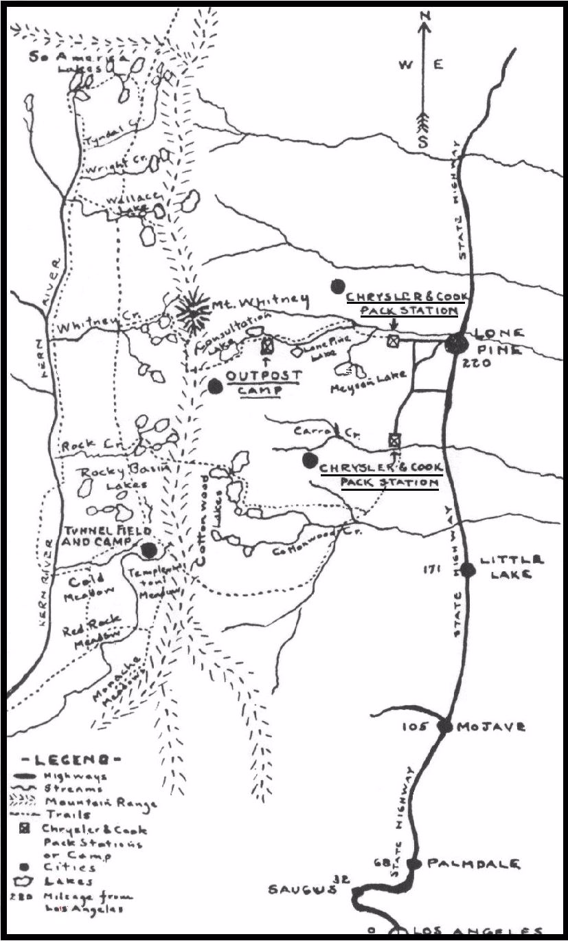
Exploring the Southern Sierra: East Side indicates that before 1967 the only trail down from Horseshoe Meadows went down Cottonwood Creek all the way to Owens Valley, but that is clearly not the case. It is a well-known fact that the Hockett Trail began at Carroll Creek, where there was once a busy pack station, shown on this map from the Inyo Independent:
Carroll Creek is now the site of De La Cour Ranch, where cabins and tent cabins can be rented at the foot of Hockett Hill.
“After leaving the plains below Lone Pine this trail rapidly climbs the dreaded Hockett Hill. All travelers try so to arrange their journey that this hill is climbed either in early morning or late in the afternoon. The real hill begins where the desert sloping up from Owens Lake meets the main mountain wall. Here a stream from the snow higher up has made a feeble growth of shrubby trees which mark the last shade and water for a long- time… The view from the trail, however, is magnificent… And just as the pines begin to come in more and an occasional patch of snow is seen on the highest ridges (July) the trail will take a little drop and halt before a small stream, the first water since leaving the bottom. This is Little Cottonwood.” — Hubert Dyer, Sierra Club Bulletin, 1893
The views are magnificent indeed, and more than a little frightening to the average back seat driver. I don’t know if I’ve ever seen a more awe-inspiring descent. I find it hard to believe that people actually ride bicycles up this mile-high monster. It makes one wonder how a trail could have been there, but the trail was there. In fact, it is shown on the 1981 Sequoia National Forest map, though it was cut at numerous points by Horseshoe Meadows Road. Much of the cliff faces seen from along that road were of course blasted for that road, and do not predate it. Also bear in mind that broad roads of this kind cannot work around the native cliffs as trails do.
See Exploring the Southern Sierra: East Side by Jenkins & Jenkins: Horseshoe Meadow Car Tour (T109) and Trail Peak Climb (T113). Also see Hiking California’s Golden Trout Wilderness by Suzanne Swedo: Trail Pass, Mulkey Pass, and the Pacific Crest Trail (27).


Hi Dan,
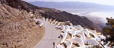
Wow!! I just found your comment and read the first page on your link. Thank you so much for mentioning DeLaCour cabins and all the information. I often rattle off as much as I know to our visitors and your site is a great additional resource. I really like the photo of the handgliders! Where did you get it? We have had one handgliding group stay with us and would love to have more. The handgliding history and crowd is just one more of the countless interesting attractions.
We have been trying to find all the old signs of the trail and have had not much luck. Your map will help!
I have garnered lots of information from locals and Coale, my partner, obtained lots of old photos and text from the county records. So many of the Lone Pine elders have history with Carroll Creek. They lived there, worked there, were born or raised there, or are somehow related to Chrysler or Cook. it’s pretty fascinating. Do you know about the miners or moonshine cabin up Wanoga Peak, either on or near the old trail? We have not found it yet, but it is there. A guy in town told us of the toilet seat he took from there. He gave it to his parents for their fiftieth weeding anniversary gift because they had spent their honeymoon in that cabin way back before the road was put in. And have you read the book, The Deepest Valley? It has tons of history… printed in the early sixties, before the road was built. And did you know that it was a man in the then Govenor Reagan’s cabinet, who stopped the developemnt of a ski resort at Horseshoe Meadow?
When Coale bought the place eleven years ago, almost no signs of the pack station existed. There had been a bad fire that wiped out all but one of the structures. Most of the old metal and such was taken by locals, which is good… it is their memories and they live on. We rebuilt the one remaining cabin and now rent it, along with a tent cabin. We are planning on additional structures, like a bunk house, in hopes of recreating more of the pack station history. We just moved down to live here full time a year ago. I’m totally in love with the place!! I especially like the history and all the potential in making it come to life.
Have you ever been up to the Monestary? There is a trail head off the end of Granite View Road, to the east of Horseshoe Meadow Road. It has an interesting history. I cannot remember the man’s name, but he and his wife built it from the stone of the mountain and took about thirty years to complete it. It now stands in slow ruin on US Forestry land overlooking two roaring creeks and the Owens Valley below. It’s quite a place.
By the way, Carroll Creek is one of the only creeks not owned by LADWP. And our little 40 acre piece was determined private way back when BLM first took inventory because it was abviously being used for a long time prior. I’m always curious as to how used it was prior to the whites settling the valley. We have several grinding stones out on the rim down the canyon from our place.
Well, I could go on forever. I will continue with your blog and see what other nuggets I can find.
Thanks again,
Julie and Coale Johnson
DeLaCour Ranch
Lone Pine
760-264-3213
Hi Julie! Good to hear from you.
You are full of interesting info bits on the area.
I think you’ve got a great plan, and I wish you and Coale all the luck in the world. It sounds like you’re “livin’ the dream”. I hope the economics work out for you, and I’d love to stay up there for a couple days and explore some time. I would expect to be able to find traces of the trail, though I expect the road and road cuts have wiped out a lot of it. Maybe the road can be seen as a widening of the trail, as the trail was originally intended for practical, economic and military purposes.
If you click on the hand glider image, your browser should open the source page, which is the Owens Valley page of Thermaling.com.
-Dan