A couple weeks after our walk-in camping experience at Sanborne-Skyline County Park, Michael and I spent a night at our family’s favorite county park, Uvas Canyon. We enjoyed a crackling campfire, some sinfully rich camp food, and a pleasant hike up the falls trail.
Tag Archives: hiking
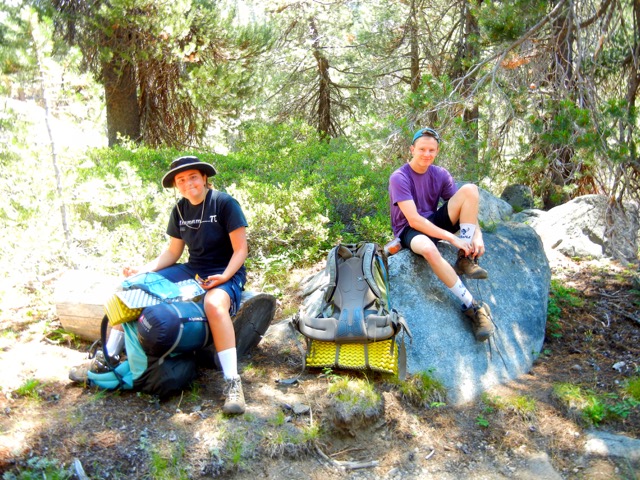
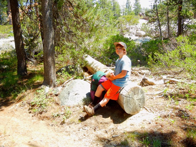
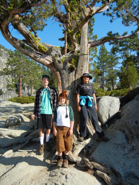
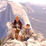
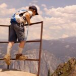
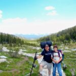
Ten Lakes

Michael pauses for the view above Ten Lakes
We returned to Twin Lakes in late August to see if the weather would permit us a pleasant high country outing, and what do you know, it did. We found a wonderful, large, flat, wooded site with a large fire pit and some well-laid logs for the night, a short walk from one of the larger lakes.
Here’s some coverage of a pair of hikers who got lost while hiking to Ten Lakes the year before.
©2014 Kaweah
Ten Lakes Rainout

Yosemite Creek Downpour
This summer’s first backcountry adventure was an attempted overnighter to Yosemite’s Ten Lakes, north of Tioga Pass Road and above the Grand Canyon of the Tuolumne River. Unfortunately, heavy rain, thunder, and lightning sent us scurrying back to the trailhead. Fortunately, we’d already got a night in at a pleasant walk-in campsite at White Wolf.
©2014 Kaweah
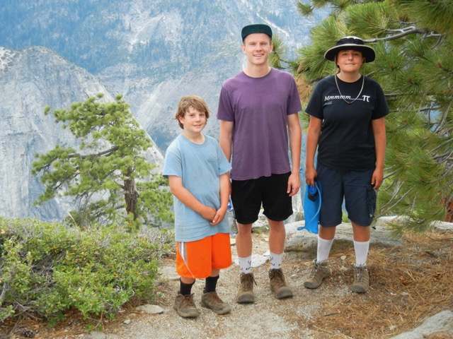
El Capitan and Yosemite Falls
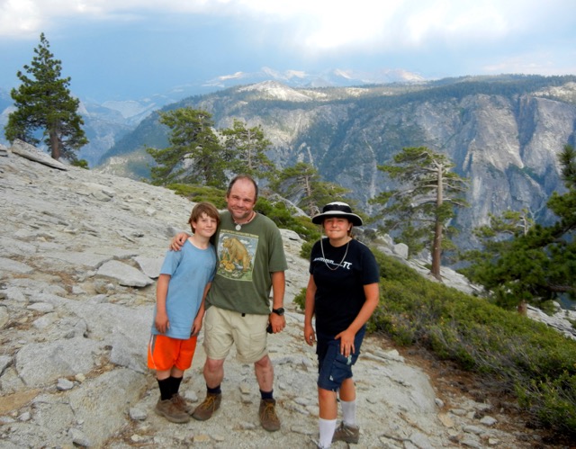
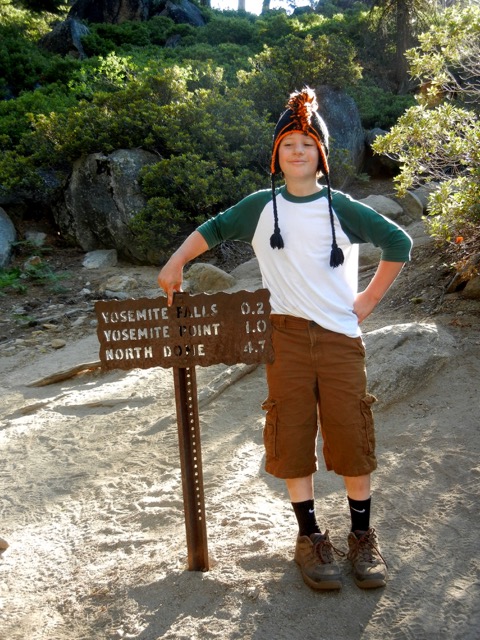
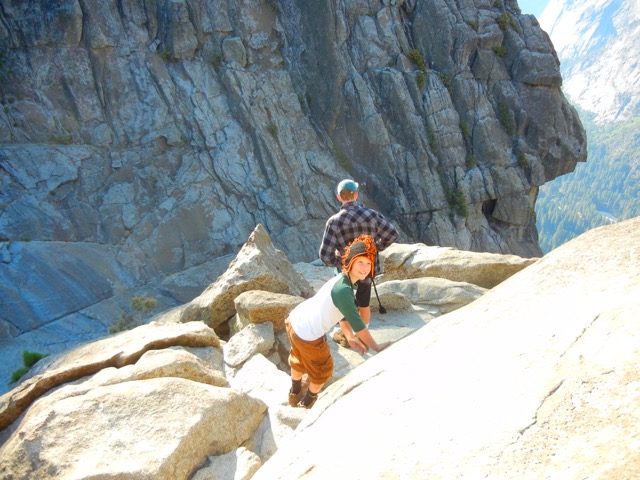
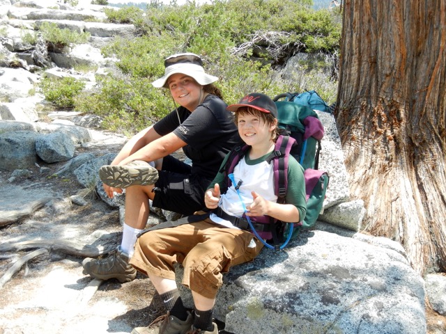
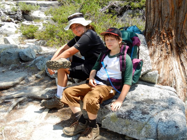
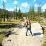
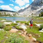
Alex and Maddie expressed interest in going backpacking this summer, so they joined Michael and I on a two-night trip down Yosemite Creek from Tioga Pass Road. Good water was a bit hard to find, but we did alright. The weather was wonderful, and we even had a neighborly “controlled burn” near camp.
-
- Alex & Maddie catch a breather during the rocky hike down Yose Creek
-
- Never pass up a chance at a gapped log.
-
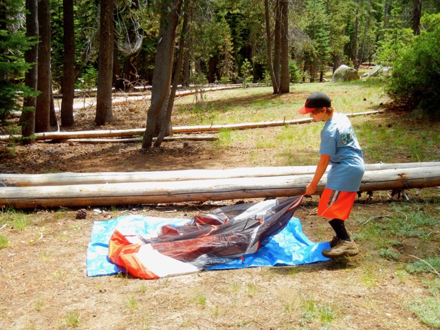
- Setting up camp above the Falls
-
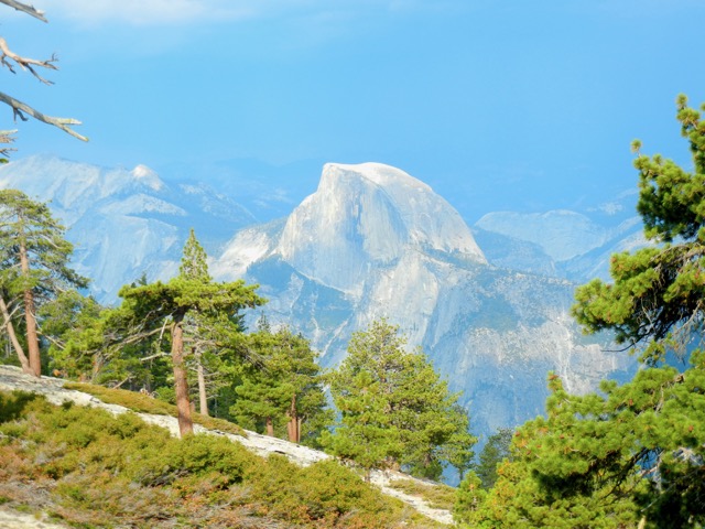
- Half Dome in the afternoon
-
- Above El Capitan’s great face
-
- El Capitan
-
- Falls Junction
-
- Descending to Upper Yosemite Fall
-
- Heading back to “base camp”
-
- Lugging it back to the car
-
- Lugging it back to the car
It had been 30 years since my brother David and I had camped above Upper Yosemite Fall during one very warm and sunny Spring Break. David and I had a great time listening to Dr. Ruth Westheimer talk sex on our little AM/FM radio, and we also hiked out to the rim at night to see the Falls glow in the moonlight—to say nothing of lights down in the valley.
© 2013 Kaweah
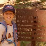
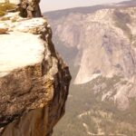
South Rim 2013
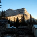
This last weekend Michael and I headed to Yosemite for some day hiking. We had to abort the Upper Fall trail because I started to overheat and got light-headed. We then drove up to the Taft Point Trailhead and walked a loop from Sentinel Dome to Taft Point — a fabulous hike. Towards the end, Michael’s boots gave him trouble so he went barefoot.
-
- Sentinel Dome
-
- Sentinel Dome
-
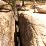
- Michael at the Fissures
-
- Getting a better look
-
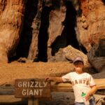
- Mariposa Grove
-

- Mariposa Grove
© 2013 Kaweah
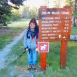
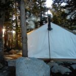
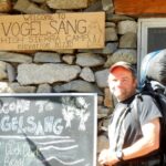
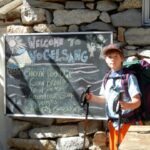
Vogelsang 2013
Michael’s first overnight backcountry trip, and we do it in style! We spent the first night at Tuolumne Meadows to acclimatize, and then headed up the JMT and then the trail to Vogelsang, Yosemite’s highest High Sierra Camp. Great food, good games, and careful with that wood stove if you don’t want to cook everyone in the tent cabin! It turns out I would have been more comfortable on the ground, but my own fault for overfeeding the thing.
© 2013 Kaweah
Hockett Trail Notes: Devils Ladder and Coyote Pass
Taking a moment to process some minutia of Hockett Trail history …
This early account of the rerouting of a short segment of the Hockett Trail appears to corroborate my understanding that the Hockett Trail followed the same route that Horseshoe Meadows Road follows today, only with shorter switchbacks:
From Round Valley down to where it leaves the Little Cottonwood the old Hockett Trail is almost untraveled. The shorter route now in use leaves the valley at the lower end, drops over the Big Cottonwood, descends this past an old sawmill, and crosses to the Little Cottonwood, which it reaches about fifty yards below where it rejoins the old trail, at the foot of the Devil’s Ladder.
E. B. C., Sierra Club Bulletin, Vol. III., No. 2, May 1900
For anyone who’s driven Horseshoe Meadows Road, names like “Devil’s Ladder” should come as no surprise. I’m guessing that this Devil’s Ladder is the name that was given to the eastbound ascent out of the Cottonwood Creek watershed to what is now called “Walt’s Point”, atop the grand descent down “Hockett Hill.”
The following demonstrates that, contrary to what appears to be a common understanding, the Hockett Trail did not cross the Great Western Divide at Coyote Pass:
Another trail in recent use is between Mineral King and the Big Kern, via Coyote (or Quinn’s ) Pass. I think they are the same. From the east it starts at the soda spring and keeps north of Coyote Creek up to the meadows. From the west it leaves the Hockett Trail, perhaps two miles south of Farewell Gap, and is indicated by a signboard—”Poison Meadow Trail.” According to the signs, the “Hockett Trail” leads to Mineral King, and the trail to Hockett Meadows is the “Hockett Meadow Trail.”
E. B. C., Sierra Club Bulletin, Vol. III., No. 2, May 1900
Valley to Valley
Here’s a tribute to Hockett country that I recently threw together, to the music of U2’s song “Elevation”. Yes, we take the song quite literally, as it serves our present purposes.
A Hockett Trail Guide: 11. Hockett Hill
Welcome to LA. No, there’s not a big green road sign announcing “Los Angeles City Limit” at Trail Pass, but maybe if there were it would not be entirely inaccurate. It is, after all, the City of Los Angeles that runs this place. It’s their water, and their power.
The Hockett Trail proceeded from Trail Pass—or possibly Mulkey Pass—down to Cottonwood Creek, then followed the approximate path of present-day Horseshoe Meadows Road, perhaps running a bit higher around Wonoga Peak to avoid some heinous cliffs.

Horseshoe Meadows Road (completed 1967) at Walts Point.
Exploring the Southern Sierra: East Side indicates that before 1967 the only trail down from Horseshoe Meadows went down Cottonwood Creek all the way to Owens Valley, but that is clearly not the case. It is a well-known fact that the Hockett Trail began at Carroll Creek, where there was once a busy pack station, shown on this map from the Inyo Independent:

Carroll Creek is now the site of De La Cour Ranch, where cabins and tent cabins can be rented at the foot of Hockett Hill.
“After leaving the plains below Lone Pine this trail rapidly climbs the dreaded Hockett Hill. All travelers try so to arrange their journey that this hill is climbed either in early morning or late in the afternoon. The real hill begins where the desert sloping up from Owens Lake meets the main mountain wall. Here a stream from the snow higher up has made a feeble growth of shrubby trees which mark the last shade and water for a long- time… The view from the trail, however, is magnificent… And just as the pines begin to come in more and an occasional patch of snow is seen on the highest ridges (July) the trail will take a little drop and halt before a small stream, the first water since leaving the bottom. This is Little Cottonwood.” — Hubert Dyer, Sierra Club Bulletin, 1893
The views are magnificent indeed, and more than a little frightening to the average back seat driver. I don’t know if I’ve ever seen a more awe-inspiring descent. I find it hard to believe that people actually ride bicycles up this mile-high monster. It makes one wonder how a trail could have been there, but the trail was there. In fact, it is shown on the 1981 Sequoia National Forest map, though it was cut at numerous points by Horseshoe Meadows Road. Much of the cliff faces seen from along that road were of course blasted for that road, and do not predate it. Also bear in mind that broad roads of this kind cannot work around the native cliffs as trails do.
See Exploring the Southern Sierra: East Side by Jenkins & Jenkins: Horseshoe Meadow Car Tour (T109) and Trail Peak Climb (T113). Also see Hiking California’s Golden Trout Wilderness by Suzanne Swedo: Trail Pass, Mulkey Pass, and the Pacific Crest Trail (27).
A Hockett Trail Guide: 10. South Fork Kern
At Tunnel or “Chickenfoot” junction we enter the domain of a slightly different subspecies of golden trout native to the South Fork Kern. This junction was once known as the turnoff to Mount Whitney, but today it is better known as the boundary of two very special watersheds; a boundary that was once infamously compromised to favor one farming community over another.

In 1886, Chinese laborers dug a tunnel between the South Fork and Golden Trout Creek to divert water to the former. One account has it that the tunnel was soon dynamited by the constituency of the latter party.
“This narrow, stream-bordered dike is the great landmark for all Whitney travelers, as here the Whitney trail leaves the Hockett. This hranching place is again indicated by a tunnel under the dike which transfers the northern stream almost wholly into the southern. The traveler approaching the forks (Tunnel forks) from either direction will notice the sudden increase in volume of the southerly stream.” — Hubert Dyer, Sierra Club Bulletin, 1893
This is the starting point of two fishing trips: one up Golden Trout Creek, on the Siberian Pass Trail, and another down the South Fork Kern River, on the Ramshaw Trail. Add to those trips Golden Trout Creek as it flows down to Kern Canyon and the upstream South Fork, and Tunnel begins to look like a great base camp.
Once you’ve got your fill of this great golden trout junction, proceed east on the Trail Pass Trail, along the north edge of Tunnel Meadow. Look for a corral about midway, then an abandoned airstrip, which we might call Tunnel International Airport, toward the far eastern end of the meadow.
“THROUGH COOPERATION, Sierra Air ways offers those of our patrons who wish to save time, fast transportation by air, thirty minutes from Lone Pine to our new camp, located in the heart of the Sierra at Tunnel landing field. Tunnel field is the highest airport in the northern hemisphere-elevation, 9,200 feet.” — Chrysler and Cook Pamphlet
The trail then follows the brook that will develop into the South Fork downstream. It may not seem like much at this point, but look again: spot the golden glistening of its native trout?
Eventually the trail pops over a gap and descends into BullFrog Meadow, and finally the cattle pastures of Mulkey Meadow, before ascending northeast toward Trail Pass, the highest point on the Hockett Trail.
Contrary to some popular accounts, the Hockett Trail did not cross the divide at Cottonwood Pass. The route over Trail Pass is shorter, easier, and much better documented among early accounts.
“The trail over Mulkey Pass is the shortest, most direct route which may be taken to reach this famous hunting area, although it may also be reached over Cottonwood Pass.” — Chrysler and Cook Pamphlet
More evidence: the Mount Whitney Trail began at Tunnel junction. If the Hockett Trail had climbed over Cottonwood Pass, there would have been no need for the Mount Whitney Trail to go so far south.
“From the summit of the watershed the trail traverses the famous Mulkey Meadows, named after a widely-known Sheriff of early days, and soon strikes the trickling source of the south fork of Kern river. It clings closely to its northern bank for a few miles and then comes out upon a narrow tongue of land, apparently a moraine, lying between two streams, branches of the south and north forks of the Kern, not more than three hundred feet apart.” — Hubert Dyer, Sierra Club Bulletin, 1893
See Exploring the Southern Sierra: East Side by Jenkins & Jenkins: Horseshoe Meadow to Kern River Backpack (T114) and Saddles, Ridges, Passes, and Kern Peak Backpack (T115). Also see Hiking California’s Golden Trout Wilderness by Suzanne Swedo: Tunnel Meadow (30) and Kern Peak (32).